
Guided Trail Home | Locations | Geology | Vegetation | Wildlife | Wellness | Photography Tips
Welcome to the Snake River Canyon Rim Tour
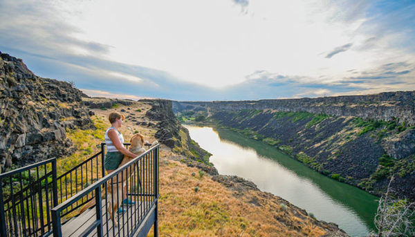
Enjoy spectacular views and a wide variety of wildlife and plant life as you walk, hike, or bike along the fully paved Snake River Rim trail. Easy access to this 6.5 mile trail is available at multiple points. Click on Locations for a map and a full list of locations.
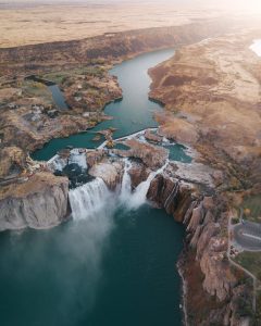
The Snake River Canyon was formed by the Snake River in the Magic Valley region of Southern Idaho, forming part of the boundary between Twin Falls County and Jerome County.
The canyon ranges up to 500 feet deep, 0.25 miles wide, and runs for just over 150 miles.
Media
QR Code/NFC Tag
Each of the 12 locations on the Trail tour are enabled with both QR Code and NFC Tag scanning capabilities.

If your smart phone is Near Field Communication enabled, you can hold your phone to the location sign and your Web page will automatically be taken to the location indicated.
If your phone isn’t NFC enabled, download and/or open a free QR Code reader app and use it to scan the QR code image and your Web page will automatically be taken to the location indicated. You can easily navigate between locations by clicking on the Locations link.
Pages in this tour were developed by Business Management and Entrepreneurship students in the Fall 2019 Project Management class at College of Southern Idaho, with expert content provided by Marsha Neibling (Vegetation), Dr. Monique Middlekauff (Wellness), Colin Randolph (Photography Tips), Shawn Willsey (Geology), Jaime Tigue (Maps), and Sarah Harris (Wildlife).