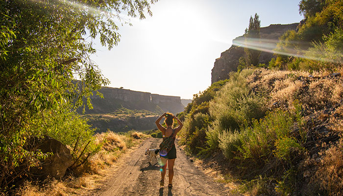
Twin Falls, Idaho is located about 2 hours from Boise. Bustling with activity, Twin Falls has grown substantially over the last decade because of the booming business and outdoor options. Where to hike in Twin Falls can be hard to find, so we’ve listed all the hikes you can bring your adventure buddies on!
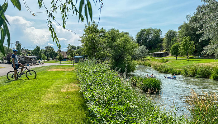
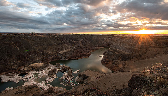
Snake River Canyon Rim Trail
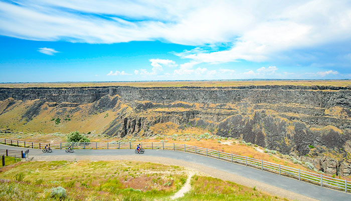
The Canyon Rim trail spans 12.3 miles and follows the gorgeous Snake River. The trail is paved and perfect for biking, roller blading, running, walking, or skate boarding. It is wheel chair and stroller accessible. There are many access points to get on the trail including, but not limited to the Visitor’s Center, Elevation 468, Shoshone Falls, or Dierke’s Lake. The trail is dog friendly but they must be on a leash. There are restrooms at the Visitor’s Center as well as Shoshone Falls City Park.
Views on the Snake River Canyon Trail include multiple waterfalls such as Perrine Coulee and Shoshone Falls. You will also see into the canyon at many viewpoints, the famous I.B Perrine Bridge and Pillar Falls. About a mile west of Shoshone Falls there is a big ramp that faces the canyon. This was once used by Evel Knievel to attempt a jump across the Snake River! There is not much shade on this path so be sure to bring plenty of water.
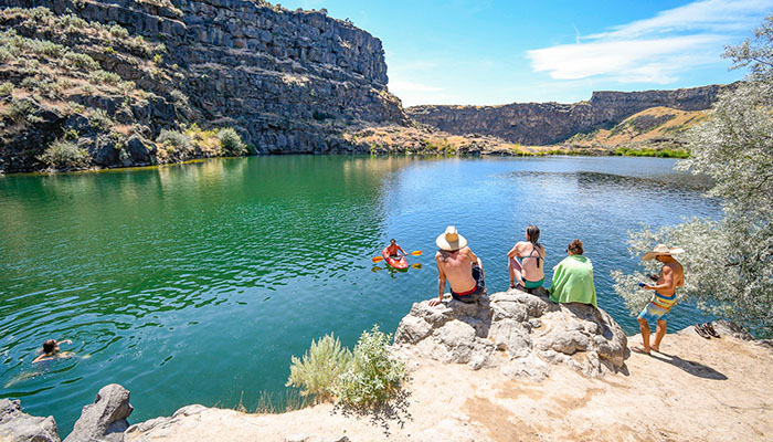
Dierke’s Lake
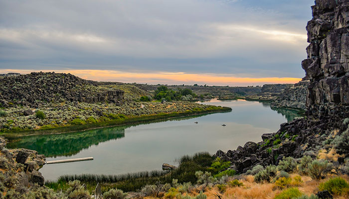
Dierke’s is a beautiful lake that sits above (east) of Shoshone Falls. There is a playground and many picnic tables for public use. There is a small beach area to swim as well as options to put in kayaks and paddle boards. Restrooms are located near the parking lot.
The walking trail is 1.7 miles that leads around the lake. Hiking this path will show you views of the lake, a boulder area that climbers utilize, views of the Snake River, and some hidden lakes off the main trail. There is a $5 vehicle fee to enter the Dierkes Lake and Shoshone Falls area from March through September. The area is desert terrain so keep an eye out for snakes and bring plenty of water to keep hydrated.
Mogensen Trail
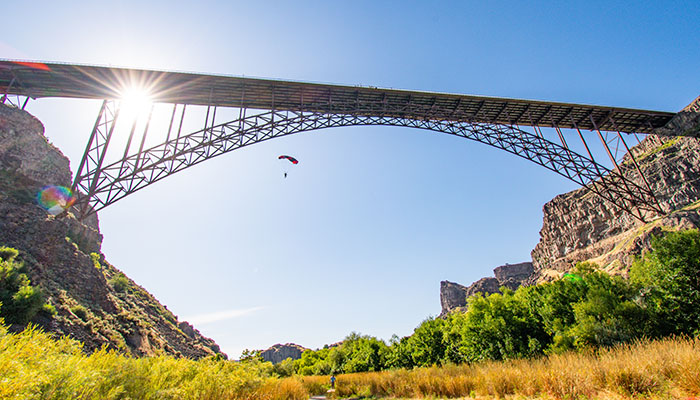
The trailhead for Mogensen Trail is on the way down to Centennial Waterfront Park. It is the second switchback where the road splits on the east side of the road. The trail spans 2.2 miles. On it you will walk down a staircase, over a wooden bridge, past small waterfalls and even under the Perrine Bridge! The end of the trail is the BASE Jumper’s landing zone. Be aware and keep your eyes in the sky to assure you’re out of the BASE Jumper’s way! It is truly amazing to sit here and watch as they leap from the bridge and land right before your eyes. There are no restrooms on this trail. Keep an eye out for snakes, poison ivy and porcupines on this trail!
Rock Creek RV Park
A great place to beat the summer heat is by heading to Rock Creek! The urban canyon has an RV park located just off of Addison BLVD. There are a few access points, but pulling off just past County West is the easiest to park your car in the park. From here there are walking trails all around that lead to waterfalls, around a disc golf course, and along the creek. There are many sitting areas and picnic tables for public use.
Auger Falls
Auger Falls Heritage Park offers a plethora of sight seeing! The drive down the canyon, past Centennial Waterfront Park showcases waterfalls all along the canyon. There is a waterfall right above the parking lot to Auger Falls trailhead as well, and there is a trail that leads below it! There are restrooms and a trail map in the parking lot. Auger Falls is a popular place to mountain bike. Be aware that bikers are cruising around any given path so pay attention to your surroundings.
The hike to Auger Falls itself is about 2 miles. On the way to Auger Falls, you will pass Broken Bridge about a mile in. Walk down the path that leads to the river to see the bridge! Looking at the north side of the canyon will show you another waterfall named Mermaid Cove. When the water is low enough, the bridge is passable and there is a trail that leads to Mermaid Cove. Because the water levels can vary on the Snake River, please do not attempt crossing unless there is no water on either side of the bridge. Once you’re back on the main path you’ll walk for another 10 minutes before trails appear to be leading towards the river. Follow one of them to find Auger Falls, the powerful riverbed waterfall. Watch your step when exploring near the water. Continuing down the main gravel path will lead you to the end of the trail where there is a large waterfall flowing into the river.
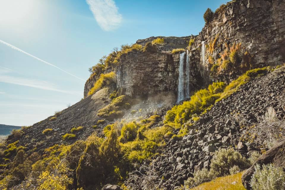
Perrine Coulee

This is a small hike that leads to and behind a waterfall! There are two options to access Perrine Coulee; one on the road leading down to the canyon where there are a handful of parking spots designated, and the other below the falls. There are a few parking options below the waterfall near Canyon Springs Golf Course. Parking below does require a longer and steeper hike up to the waterfall. There is an obvious path that switches up the canyon taking you right to a walk behind the falls. If you park on the road next to Perrine Coulee it just requires a small maneuver through trees and to the waterfall. You will get wet if you walk behind the waterfall, and it is worth every drop!
Yingst Grade
Mermaid Cove, as we mentioned above, is found on Yingst Grade. This grade is on the Jerome or north side of the canyon and parking is at the top. There are no restrooms at this trailhead. The hike to Mermaid Cove is very short and downhill. Mermaid Cove is a powerful waterfall with beautiful views. The grade continues down the canyon, all the way to the Snake River and to the Broken Bridge that connects to Auger Falls. Mermaid Cove is a two part waterfall, so as you continue down the grade you will see the larger drop below.
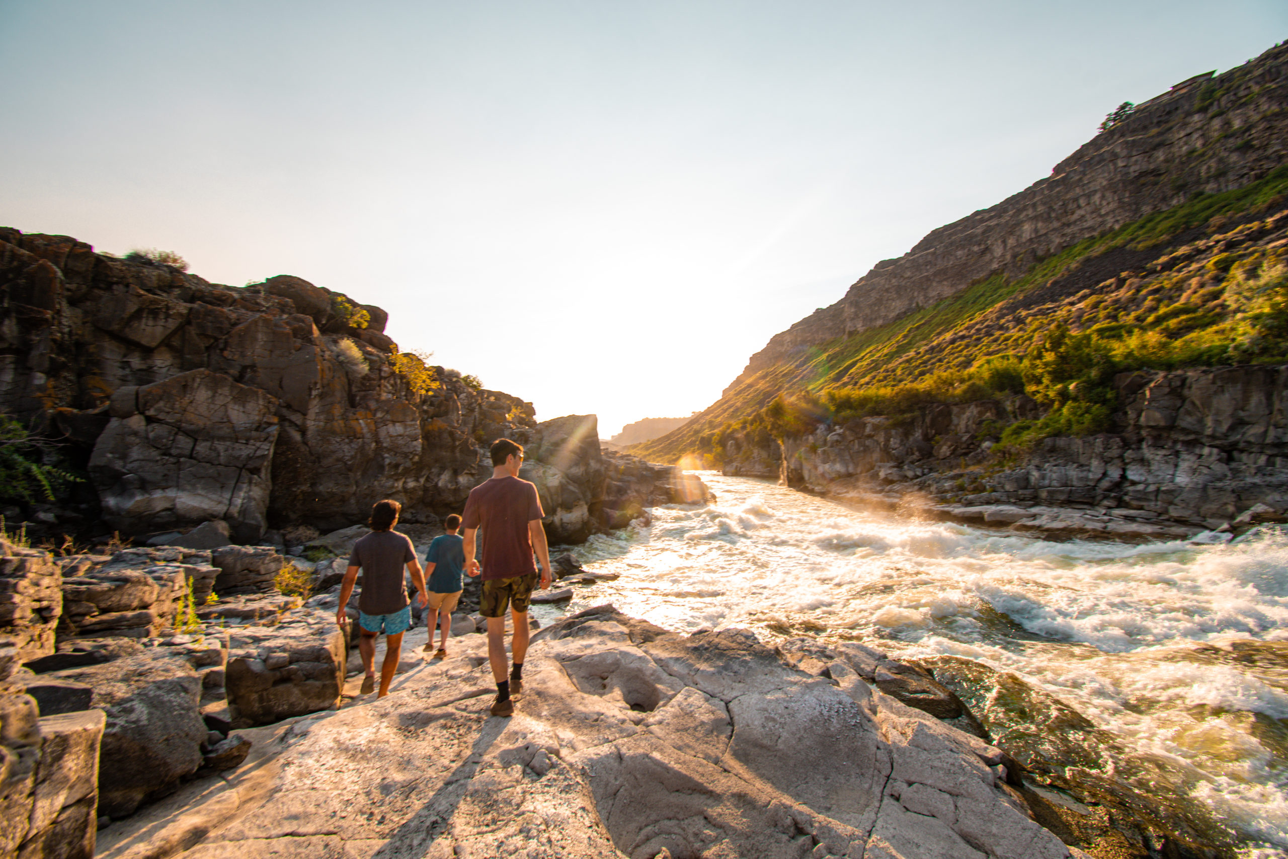
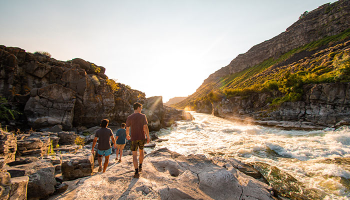
Pillar Falls
Pillar Falls is located in the Snake River Canyon, halfway from Centennial Waterfront Park and Shoshone Falls. The hike to Pillar Falls is extremely steep and requires gripped shoes. The only way to access this trail is by parking at the corner of Eastland and Poleline. This parking lot is very large and has one restroom. It also provides access to the Canyon Rim Trail, but rather than taking the paved trail, walk east on the residential road to access Pillar Falls. Its less than a half mile to the trail head. The trail is gravel and steep, leading down several switchbacks. Follow the main trail all the way down to a fork in the road. The west fork leads to a waterfall, and the east fork leads to Pillar Falls. Walk through the last jungle-esc section to arrive at the river. Pillar Falls is only accessible when the water is low because the walking area can be totally submerged in the water. Always check flows before you go!
Vinyard
Vinyard Lake is hidden away in the Snake River Canyon. The only way to this lake is through a field, down the canyon, and over crumbled rocks. It is a demanding adventure.
It is located on back roads just west of the Hansen Bridge. The dirt road has room for parking to the side. From there, the path leads through a pasture and to the top of the canyon. In the distance, the lake is visible. Because the path winds down caved in rocks and through brush, be mindful of snakes on and off the trails. Carefully step over rocks to reach the final destination. The total hike takes on average one hour.
Scotts Pond
Located south-west of Jerome, Scott’s Pond is one of the few places with access to the Snake River. There is parking on the top of the canyon to get to Scott’s Pond. The hike is about a mile down, and pretty steep coming back up. It is a well known fishing area, but also great for a sunset hike with friends!